
Leaving in less then 2 hrs for Boyne Thunder. Can't wait to get up north.
Todd
Thread: Boyne Thunder From Us Amatuers
Results 1 to 20 of 70
-

 Boyne Thunder From Us Amatuers
Charter Member
Boyne Thunder From Us Amatuers
Charter Member

- Join Date
- Oct 2008
- Location
- ada/grand haven,mi
- Posts
- 719
07-05-2016 01:20 PMBig Seas and Deep Vee's
36' Deep Impact trip 300's, 19' Baron surface drive
Ada Logistics your Flatbed Pro's
-
Registered

- Join Date
- Feb 2010
- Location
- spring lake mi
- Posts
- 191
07-05-2016 09:40 PMTodd,
c ya up there. went up for fourth, came home to clean and get boat and heading back w many boats Thursday.
by the way that construction zone does suck. not towing through that
jamie
-
Founding Member / Super Moderator


- Join Date
- Oct 2008
- Location
- West Michigan
- Posts
- 37,859
- Blog Entries
- 45
07-05-2016 10:20 PMConstruction zone where?
Getting bad advice is unfortunate, taking bad advice is a Serious matter!!
-
Registered
- Join Date
- Feb 2010
- Location
- spring lake mi
- Posts
- 191
07-06-2016 05:19 PMFrom, the turn off to Gaylord, down the hill and on the flat going to boyne falls. 1 lane in spots and no shoulder. Bt sent email out about it.
-
07-07-2016 12:56 AM
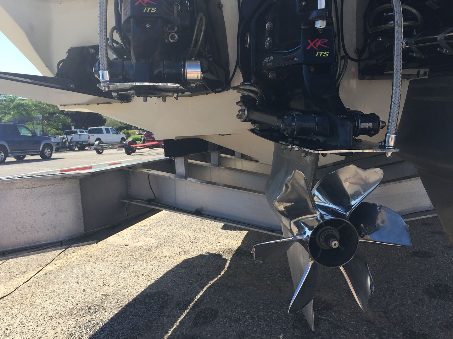
Boyne Thunder early victim!! "Where's the rest of my port drive?
"I fought a log and the log won."
-
Charter Member

- Join Date
- Oct 2008
- Location
- Serious is the BOMB!
- Posts
- 7,073
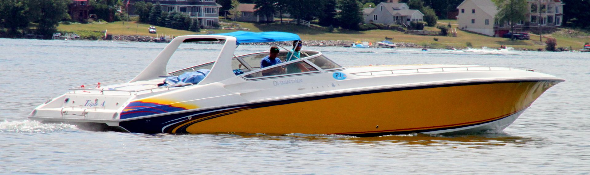
07-07-2016 01:43 AMThe ultimate shorty...
P-4077 "The Swamp" S.B.Y.C. and Michigan medboat mothership
-
Founding Member / Super Moderator
- Join Date
- Oct 2008
- Location
- West Michigan
- Posts
- 37,859
- Blog Entries
- 45
07-07-2016 09:30 AMI've never seen a lower ripped off that cleanly before. He made it all the way back to Charlevoix from Leland area on two engines though. Even missing one drive and with that destroyed prop........
Getting bad advice is unfortunate, taking bad advice is a Serious matter!!
-
Founding Member / Super Moderator
- Join Date
- Oct 2008
- Location
- West Michigan
- Posts
- 37,859
- Blog Entries
- 45
07-07-2016 08:17 PM
 Getting bad advice is unfortunate, taking bad advice is a Serious matter!!
-
Founding Member / Super Moderator
- Join Date
- Oct 2008
- Location
- West Michigan
- Posts
- 37,859
- Blog Entries
- 45
07-07-2016 08:17 PM
 Getting bad advice is unfortunate, taking bad advice is a Serious matter!!
-
Founding Member / Super Moderator
- Join Date
- Oct 2008
- Location
- West Michigan
- Posts
- 37,859
- Blog Entries
- 45
07-07-2016 08:18 PM
 Getting bad advice is unfortunate, taking bad advice is a Serious matter!!
-
Founding Member / Super Moderator
- Join Date
- Oct 2008
- Location
- West Michigan
- Posts
- 37,859
- Blog Entries
- 45
07-07-2016 08:18 PM Getting bad advice is unfortunate, taking bad advice is a Serious matter!!
-
Founding Member / Super Moderator
- Join Date
- Oct 2008
- Location
- West Michigan
- Posts
- 37,859
- Blog Entries
- 45
07-08-2016 11:38 AMSpecial Marine Warning
SPECIAL MARINE WARNING
LMZ323-081600-
/O.NEW.KAPX.MA.W.0013.160708T1530Z-160708T1600Z/
BULLETIN - IMMEDIATE BROADCAST REQUESTED
SPECIAL MARINE WARNING
NATIONAL WEATHER SERVICE GAYLORD MI
1130 AM EDT FRI JUL 8 2016
THE NATIONAL WEATHER SERVICE IN GAYLORD HAS ISSUED A
* SPECIAL MARINE WARNING FOR...
GRAND TRAVERSE BAY SOUTH OF A LINE GRAND TRAVERSE LIGHT TO NORWOOD
MI...
* UNTIL NOON EDT
* AT 1129 AM EDT...A SEVERE THUNDERSTORM WAS LOCATED NEAR OLD MISSION
LIGHTHOUSE...MOVING NORTHEAST AT 35 KNOTS.
HAZARD...WIND GUSTS IN EXCESS OF 50 KNOTS AND LARGE HAIL.
SOURCE...RADAR INDICATED.
IMPACT...BOATS COULD SUFFER SIGNIFICANT STRUCTURAL DAMAGE IN HIGH
WINDS AND HAIL. SMALL CRAFT COULD CAPSIZE IN SUDDENLY
HIGHER WAVES.
* LOCATIONS IMPACTED INCLUDE...
NORTHPORT...OLD MISSION LIGHTHOUSE AND SUTTONS BAY.
PRECAUTIONARY/PREPAREDNESS ACTIONS...
MOVE TO SAFE HARBOR IMMEDIATELY AS GUSTY WINDS AND HIGH WAVES ARE
EXPECTED.
&&
A SEVERE THUNDERSTORM WATCH REMAINS IN EFFECT UNTIL 600 PM EDT FOR
NORTHERN MICHIGAN.
LAT...LON 4491 8565 4516 8565 4537 8485 4536 8486
4530 8501 4529 8514 4525 8528 4499 8531
TIME...MOT...LOC 1529Z 245DEG 35KT 4505 8548
HAIL...>.75IN
WIND...50KTSGetting bad advice is unfortunate, taking bad advice is a Serious matter!!
-
Founding Member / Super Moderator
- Join Date
- Oct 2008
- Location
- West Michigan
- Posts
- 37,859
- Blog Entries
- 45
07-09-2016 12:11 AM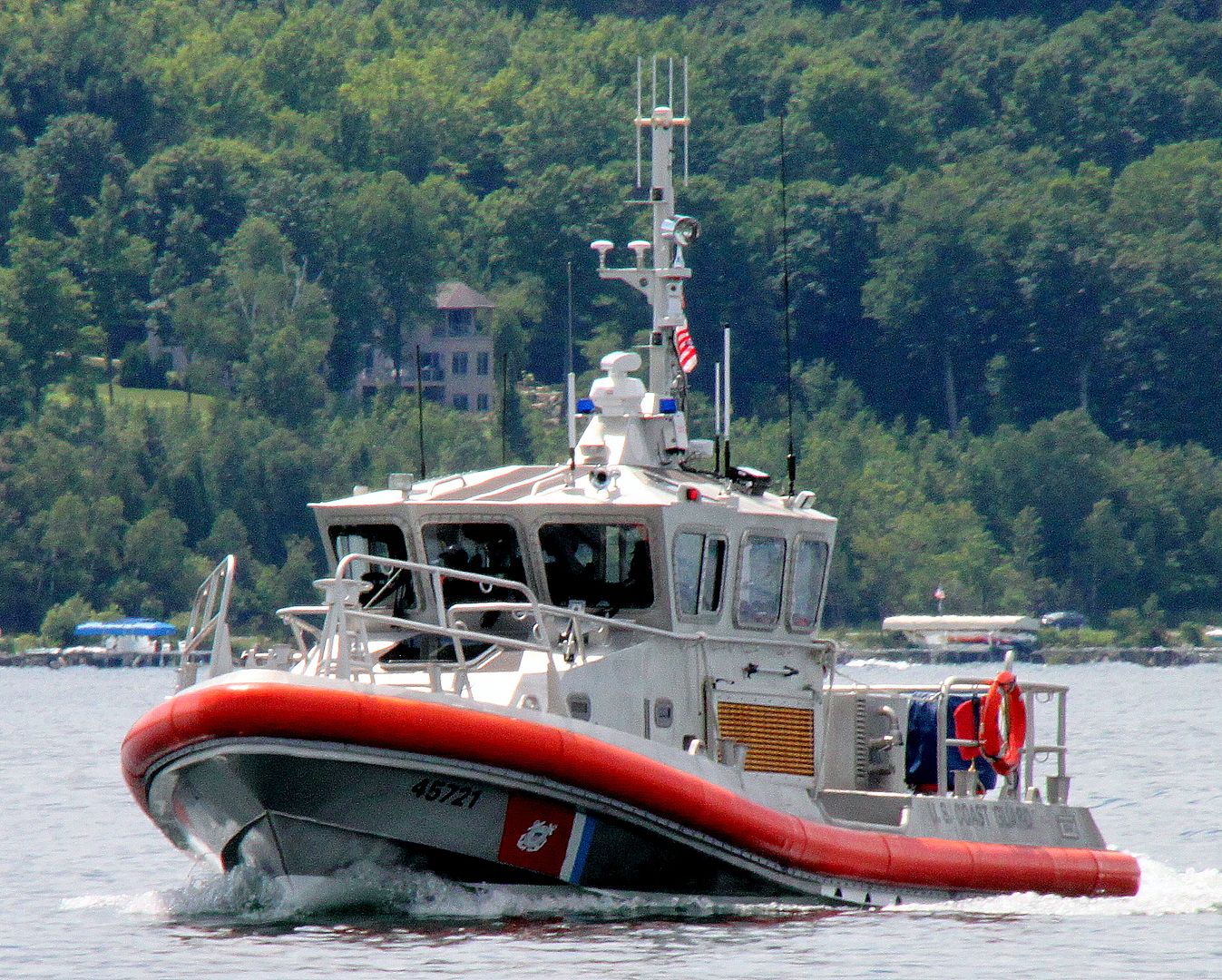 Getting bad advice is unfortunate, taking bad advice is a Serious matter!!
-
Founding Member / Super Moderator
- Join Date
- Oct 2008
- Location
- West Michigan
- Posts
- 37,859
- Blog Entries
- 45
07-09-2016 06:54 AMWeather forecast is looking pretty good. Cool but no rain today like we've had the last two days.
 Getting bad advice is unfortunate, taking bad advice is a Serious matter!!
-
Founding Member / Super Moderator
- Join Date
- Oct 2008
- Location
- West Michigan
- Posts
- 37,859
- Blog Entries
- 45
07-09-2016 06:55 AM
 Getting bad advice is unfortunate, taking bad advice is a Serious matter!!
-
Founding Member / Super Moderator
- Join Date
- Oct 2008
- Location
- West Michigan
- Posts
- 37,859
- Blog Entries
- 45
07-09-2016 06:55 AM
 Getting bad advice is unfortunate, taking bad advice is a Serious matter!!
-
Founding Member / Super Moderator
- Join Date
- Oct 2008
- Location
- West Michigan
- Posts
- 37,859
- Blog Entries
- 45
07-09-2016 06:56 AM
 Getting bad advice is unfortunate, taking bad advice is a Serious matter!!
-
Founding Member / Super Moderator
- Join Date
- Oct 2008
- Location
- West Michigan
- Posts
- 37,859
- Blog Entries
- 45
07-09-2016 06:56 AM
 Getting bad advice is unfortunate, taking bad advice is a Serious matter!!
-
Founding Member / Super Moderator
- Join Date
- Oct 2008
- Location
- West Michigan
- Posts
- 37,859
- Blog Entries
- 45
07-09-2016 06:57 AM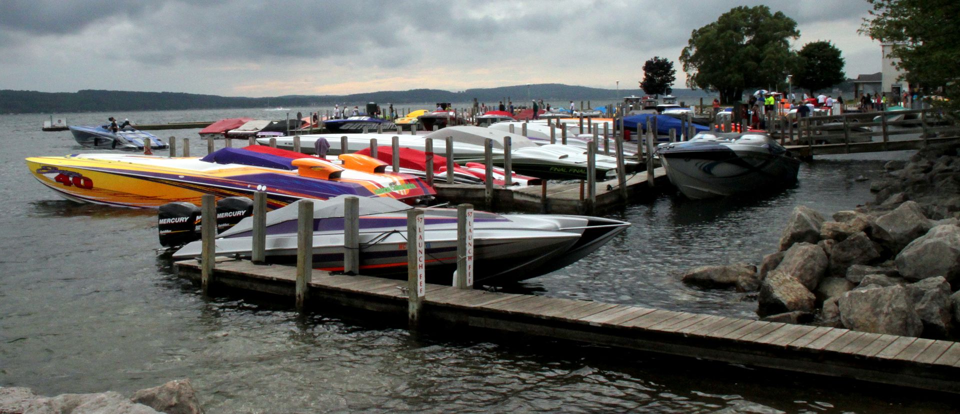 Getting bad advice is unfortunate, taking bad advice is a Serious matter!!
-
Founding Member / Super Moderator
- Join Date
- Oct 2008
- Location
- West Michigan
- Posts
- 37,859
- Blog Entries
- 45
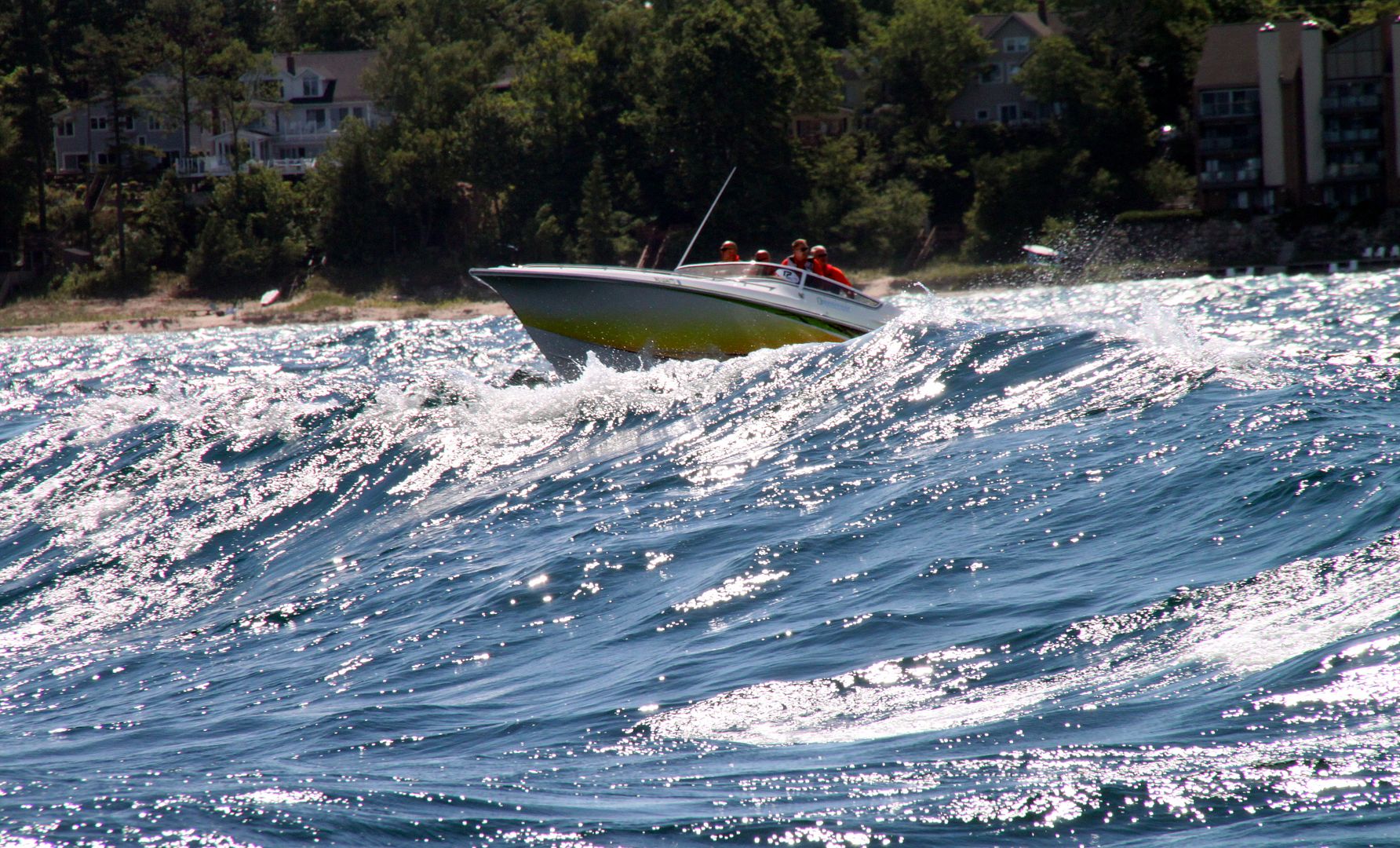
07-09-2016 06:01 PMLake Michigan was a bit rough.......
 Getting bad advice is unfortunate, taking bad advice is a Serious matter!!


Posting Permissions
- You may not post new threads
- You may not post replies
- You may not post attachments
- You may not edit your posts